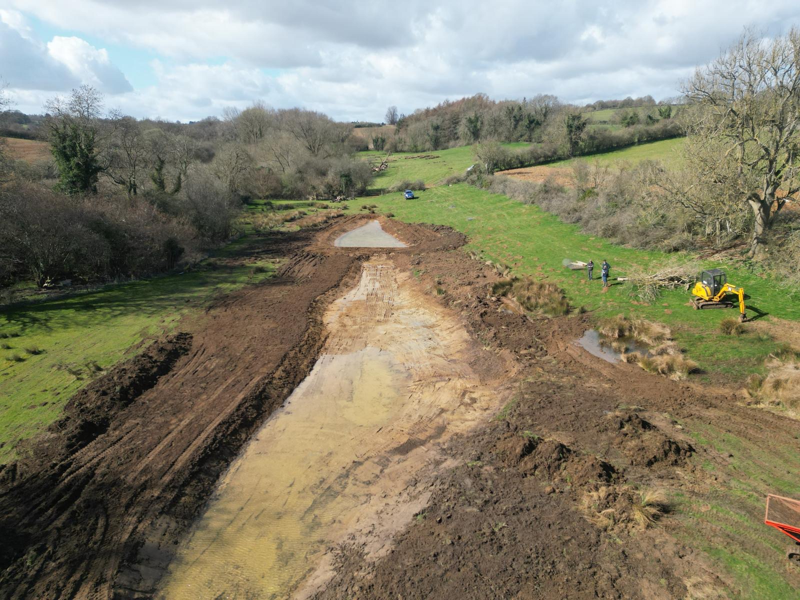
The Cherwell and Tributaries Landscape Restoration Project

A farmer-led project restoring the ecological condition of the River Cherwell and its tributaries across a largely arable catchment in north Oxfordshire, through floodplain reconnection, river remorphing, wetland creation and nature-based flood management. Delivered in partnership with a growing farmer cluster of over 35 members, three tributary schemes on the River Swere, Deddington Brook and Sor Brook are already in active development, forming the core of what could become a Landscape Recovery-scale programme.

The Cherwell and Tributaries Landscape Restoration Project

Indicative funding required
~£100,000 per annum for project development
Funding already secured
Early feasibility funding
Types of funding required
Grant and Philanthropic funding initially before transitioning to blended finance

Key information

Lead organisation
Cherwell Farmer Cluster (NECFC CIC)
Local Planning Authority (LPA)
Cherwell District Council
Key partners

Cherwell District Council; Oxfordshire CountyCouncil (LNRS); Thames21; BBOWT; the Environment Agency; and the Cherwell andRay Catchment Partnership, which provides wider catchment coordination.

‍

Total area
~100 ha of floodplain currently with potential to scale to ~10,000 ha

Ecology and character

Habitat type availability
Lowland wet grassland and floodplain meadow; wetland scrapes and shallow open water; wet woodland; reedbed and fen; reconnected paleochannels and backwaters; improved riparian buffer strips.
Key ecological outcomes
Water vole; wading birds including snipe, lapwing and curlew in floodplain areas; farmland birds including corn bunting; aquatic invertebrates; river macrophytes; and white-clawed crayfish refuge potential in isolated tributaries. Bestmoor SSSI is a key downstream receptor and a target for improved hydrological condition. Wider expected outcomes include floodplain reconnection and natural flood management reducing downstream flood risk; improved water quality through riparian buffer creation, sediment interception and reduced agricultural diffuse pollution; and improved ecological status of tributary watercourses towards Water Framework Directive good ecological status.
National Character Area (NCA)
Cotswolds and Upper Thames Clay Vales
Designated sites
Bestmoor SSSI lies at the confluence of Deddington Brook and the Cherwell and is a direct downstream receptor of the Deddington Brook scheme. The wider catchment borders or contains further Local Wildlife Sites.
LNRS alignment
Strong – project area falls within LNRS core and recovery zones for wetland, floodplain grassland and riparian habitat

Ecosystem services and wider benefits

Expected/planned ecosystem services
Not currently confirmed but a range of ecosystem services possible (flood risk reduction; water quality; BNG; voluntary carbon)
Wider benefits
The project is built around a farmer cluster of over 35 members with elected farmer Directors, supporting peer learning, shared ambition and farmer-led decision-making across the catchment. Nature-based flood management in the upper catchment offers direct benefit to downstream communities through reduced flood risk, alongside improved water quality across the catchment. There is also potential for nature-based education and farm visits aligned to the cluster's existing farmer network, though this is not a primary focus at this stage.

The River Cherwell and its tributaries are in poor ecological condition. Water quality is failing across the catchment, hydromorphology has been severely modified by historical channel straightening, and the largely arable landscape generates significant fine sediment and nutrient loading. The Cherwell and Tributaries Landscape Restoration project is addressing this at a catchment scale, working to reconnect floodplains, remorph river channels, create wetland and deliver nature-based flood management across a landscape that also faces major housing and infrastructure growth pressure. Nature-based flood management in the upper catchment could significantly reduce risk to downstream communities, while the corridor between Otmoor and the wider Cotswold landscape represents a strategic nature recovery link that is currently missing.

The project is led by the Cherwell Farmer Cluster (NECFC CIC), and its distinctive strength is its delivery vehicle: a strong, active farmer cluster with over 35 members and genuine farmer-led governance. This provides the durable, trusted structure that nature recovery investors most commonly find lacking, with the CIC offering a governance layer above individual landholdings. Three tributary schemes - on the River Swere, Deddington Brook and the Sor Brook - have secured feasibility funding and are in active development, with ecological baselines, landowner agreements and outline designs underway. Together they cover approximately 100 hectares of floodplain land, providing near-term proof of concept within a cluster geography of around 10,000 hectares of farmland with restoration potential.

Habitat work focuses on lowland wet grassland and floodplain meadow, wetland scrapes and shallow open water, riparian and floodplain woodland, reedbed and fen, reconnected paleochannels and backwaters, and improved riparian buffer strips. Such work benefits water vole; wading birds including snipe, lapwing and curlew; farmland birds such as corn bunting; and river macrophytes, with white-clawed crayfish refuge potential in isolated tributaries. Natural flood management opportunity modelling has already been completed for the wider catchment, giving an evidence-based picture of flood risk reduction value. The project is a sister to the Evenlode Landscape Recovery, with shared infrastructure and lessons learned, and is activelye xploring a Landscape Recovery Round 3 bid as the primary mechanism for scaling- with the longer-term ambition of a joined-up nature recovery spine across north Oxfordshire.

Contact this project

Get in touch

Feasibility
Funding required
~£100,000 per annum for project development
Contact
Tom Hall
Find out more